
The use of geographic information systems (GIS) in noise mapping and acoustic surveys
Analysis of the evolution
of noise impact
From this analysis, areas where noise exposure exceeds the established Noise Quality Objectives can be precisely identified. Thanks to the comprehensive visualisation of the data on the noise maps, it is possible to compare the evolution of the noise impact over time and to evaluate the effectiveness of the reduction measures implemented.
Integration of
demographic data
GIS also allows the integration of demographic data into these models, which facilitates the analysis of the population affected by noise. This approach helps public and private entities to develop noise control policies that prioritise particularly sensitive areas, such as hospitals, schools, cultural buildings and residential areas, for which noise reduction is critical to protect the health and well-being of the community.
Simulation of noise scenarios
in developing areas
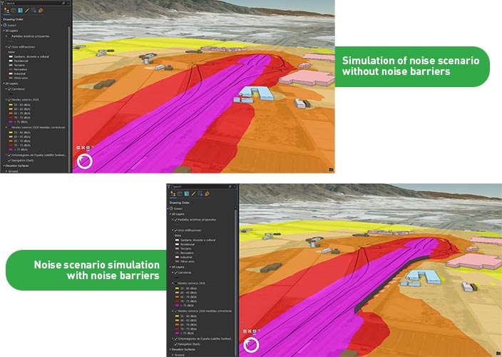
In addition, GIS offers the possibility to simulate noise scenarios in developing areas, allowing the prediction of the noise impact of future infrastructure such as new roads, railway lines and buildings. This simulation capability facilitates informed decision-making by designers and planners, who can assess the optimal location for noise barriers, select building materials that help mitigate noise, or implement special pavements that reduce sound propagation.
In short, GIS not only provides a powerful tool for monitoring and managing environmental noise, but also allows the anticipation of its impact, contributing to the development of healthier and more sustainable environments.